Lick Fire Log
Chris Weske
Monday, September 3, 2007
I was assigned to the fire yesterday as a fire monitor. I was on the east side on branch I. Our shift was
from 6:30 a.m. till 11:30 p.m. Here are a few observations:
— The Scherrer Trail is now about ten feet wide. This was used as a firing
line down to Kaiser Aetna Road. Kaiser Aetna Road was burned out from Scherrer Trail to the Orestimba Corral.
The Narrows, between the end of Kaiser Aetna Road and the Corral, are no longer narrow. It is now two
lanes wide. The corral itself was protected. There was a spot fire across Kaiser Aetna Road which may have
burned as far as Dutch's Trail. I did not see this myself, and info was sketchy this morning.
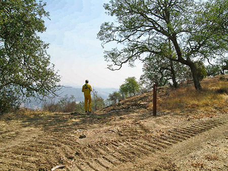
Scherrer Trail at Center Flats Road
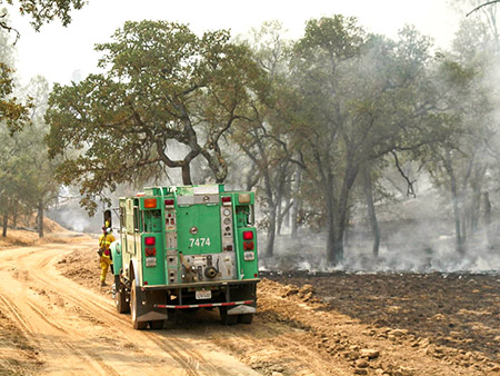
— The Orestmba Creek Road was burned out, there was only one small spot fire which the crews picked right up.
The intent was to burn out Red Creek. The fire jumped the creek, and as of the end of my shift, was
burning on the 2320 foot ridge on its way to Robison Mountain. An attempt was made to get a dozer
up there, but they soon gave up. The plan is pull back and fire out the wilderness area. Crews were
brushing out around the Rooster Comb Ranch in preparation for the burn out.

Setting a backfire on Kaiser Aetna Road at County Line Road
— Our prescribed burn plot III on the east side of Willow Ridge down to Pacheco Creek was due to be
burned out today.
— My partner from Mt. Diablo reported that he was watching the developing smoke column on
Monday. The fire developed such a convective column Monday that ash was falling in Los Banos.
— All things considered, and considering past practices, the damage from the firefighting effort on this
branch was not too bad. It is not great, but we have seen worse. I did not see any of the other lines
and I understand that this is not the case on the other branch. Fire line rehab work may start the first
part of next week.
That is all I have to offer at this time. I am due back at 0600 Saturday morning.
Near Orestimba Corral
Saturday, September 8, 2007
I only worked a twelve hour shift today.
I was assigned to Branch I (the north and east side of the fire) again. Before I could get my gear on the truck, I was reassigned to Branch II Division Z. This area includes Blue Ridge and Poverty Flat. The fire is out in these areas and the Road Repair Group and Fire Suppression Repair Group are beginning repairs. We had an Alameda County Fire dozer, a CDF (Cal Fire) dozer, a State Park grader operated by CDF, and several water tenders. Anyone who had the chance to experience Poverty Flat Road after last year’s China Fire would be quite surprised to see it now. It is smooth and firm. Prior to repairs, all the traffic and dozers had turned it to the consistency of flour. I would say it might even be in better shape now but, I can’t. It was made quite clear that they can only repair what was damaged, not make any improvements. Work will continue on Blue Ridge Road tomorrow. Plans are being made on what to do with the lines which did not follow roads such as Blue Ridge to the Middle Fork, Jackass Peak, Willow Ridge Trail etc.
Blue Ridge Road near the top of Jackass Trail
Active firing continued on the north portion of the fire. Enough heat was generated to create an updraft which cleared the smoke from the valleys below. At one point a convective column rose to an estimated 10,000 to 14,000 feet . The top of the smoke column turned to ice.
For those who have struggled with parking cars at headquarters on a busy spring day, try to envision five dozer transports (truck or truck and trailer used to haul bulldozers ) parked behind the Ranch House. They fit. Sorry, I did not get any photos.
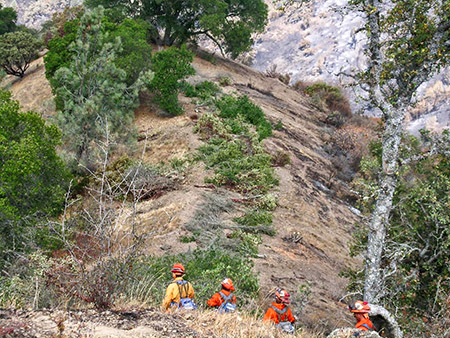
My partner today was a State Park Burn Team member from Anza Borrego. We have had team members from the Sierra District, San Luis Obispo, Mt. Diablo, and Santa Cruz, as well as other units which I do not recall at this time. A CDF archeologist was working with our Monterey District archaeologist (BLM also had a archaeologist on site). Two CDF foresters were coordinating the line rehab.
Harold, our mascot snake from the Dowdy VC, will be staying at San Juan for awhile.
That is all for now. My next shift is Wednesday.
Wednesday, September 12, 2007
Another twelve hour shift. Not all of those twelve hours were in the field however. The fire bureaucracy caught up with some of us this morning. Last week we were advised that State Park personnel did not need to check in with CDF. This morning that changed. This would not be a big deal except that this morning CDF was geared up to check people out, not in. After going through about three people and a couple of phone calls, we had our order numbers and were officially checked in for the incident.
The incident is quickly winding down. Functionally this morning the incident was handed over to the local CDF unit from the state wide incident management team. Officially this occurred at noon. The fire line perimeter is about sixty miles long. CDF had ten engines and two hand crews on the lines today. This will be down to five engines tomorrow. Assigned to fire suppression repair (rehab) were two excavators, one dozer (out of service due to a burned out bearing), and the previously mentioned hand crews. State Parks had six teams out to monitor and assist with rehab.
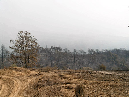
Rehab work on Eagle Pines Trail
If all goes well, most of the heavy line rehab will be completed by the end of this week. The fire burned in a mosaic pattern. Some areas burned very hot. Other areas experienced a cooler understory burn.
Let’s hope for some gentle autumn rains to settle the soil and get things growing.
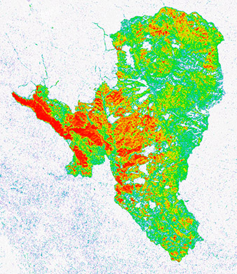
Fire Intensity Map — Red = Severe, Blue = Slight
|